
Svaneti · Georgia
The Transcaucasian Trail Through Upper Svaneti
The Transcaucasian Trail’s official Upper Svaneti section runs for about 140 kilometres from Chuberi in the Nenskra Valley to Ushguli.
On this page
Overview
The Transcaucasian Trail’s official Upper Svaneti section runs for about 140 kilometres from Chuberi in the Nenskra Valley to Ushguli. The Transcaucasian Trail Association describes it as a seven-to-nine-day, self-supported hike crossing five major mountain passes. Mestia sits roughly at the midpoint.
That single line joins two very different hiking experiences. West of Mestia, the trail is quieter and demands more independence. East of Mestia, it overlaps the popular Mestia–Ushguli corridor, where guesthouses and other hikers are much more common. Walking the full section gives both: remote forest and pass travel first, then the well-known village trek beneath the high peaks of Upper Svaneti.
This page is an orientation, not the route authority. The official TCT map, downloadable trail notes and current GPX must be checked immediately before departure. Bridges wash out, construction alters paths, vegetation returns and markings change.
The route in five official sections
The TCT divides the Upper Svaneti route into five planning sections:
- Chuberi to Nakra
- Nakra to Becho Valley
- Becho Valley to Mestia
- Mestia to Adishi
- Adishi to Ushguli
Those are planning units, not mandatory day stages. Your overnight stops depend on fitness, accommodation, weather and whether you are camping. Export the current official GPX and read the corresponding notes for each section rather than building an itinerary from an old travel blog.
The Transcaucasian Trail Association’s practical information describes the hiking season as roughly July to September, sometimes into mid-October. The TCTA states that the trail is not completely snow-free until July, and its notes mention possible snow on high ground early or late in the season; the official trail notes also describe early-season river crossings as more difficult — on at least one river, as challenging or impossible on foot early in the season. These are general patterns from the official practical information and trail notes, not a forecast for your dates. Check current conditions before you commit.
The official trail page says most of the route is marked with red-and-white and/or yellow-and-white blazes and yellow directional signs. “Most” matters. Waymarking does not remove the need for an offline map, a charged device and navigation competence.
West of Mestia: the quieter half
Chuberi, Nakra and the Becho Valley make the western half more than an approach to the famous trek. The route moves through deep forest, open mountain ground and inhabited valleys that see far fewer walkers than the section east of Mestia.
That solitude changes the planning standard. Do not assume a bed, meal or shop will fall at the end of every preferred day. The official TCT notes mention guesthouses and food in some villages, but accommodation patterns and seasonal opening can change. Confirm what is open; carry enough food and shelter for the plan you actually have.
This is the half for hikers who enjoy independent route management and are comfortable adjusting a day without a line of trekkers to follow. It is a poor choice for someone treating a GPX track as a substitute for judgement.
Becho can also serve as a useful pause or exit point. If weather or fatigue breaks the through-hike, reaching a road-accessible valley and reorganising is a sound decision, not a failed expedition.
Mestia is the reset point
Mestia changes the journey. It offers the route’s widest choice of accommodation and food, along with pharmacies, ATMs and transport. Restock food and stove gas here, but do not count on replacing specialist gear. Use it as a deliberate reset rather than rushing through to preserve a notional schedule.
Tasks for the rest day are practical:
- download the newest official notes for the eastern sections;
- check weather and river information locally;
- inspect footwear and treat any developing foot problems;
- recharge every device and power bank;
- withdraw cash for village services;
- reconfirm beds or decide where you will camp;
- reassess whether the group is still moving at the planned pace.
If you begin in Mestia, you are not walking the complete Upper Svaneti TCT section. You are joining its eastern half, which is also the classic Mestia–Ushguli trek. That is a strong trip in its own right; name it accurately.
East of Mestia: popular does not mean automatic
The route from Mestia toward Adishi and Ushguli receives more traffic and has a stronger guesthouse pattern. It is still a mountain journey over steep, high terrain with river, weather and navigation hazards.
The official TCT warning for the whole Upper Svaneti section specifically identifies difficult route-finding, challenging trail conditions, washed-out bridges, dangerous high-water crossings, aggressive dogs guarding livestock, giant hogweed and frequent summer thunderstorms with intense lightning. Search and rescue or medical care may not be readily available. The Georgian emergency number is 112; the TCTA notes that the nearest hospital, in Mestia, has severely limited services. The TCTA also states that trail users are ultimately responsible for all decisions about route, conditions, weather and safety; this page does not change that.
Crowds can create false confidence. A person ahead of you may be off-route. The official trail notes point out that water is usually lowest early in the morning and, early in the season, can be high and powerful even then; a crossing that was manageable in the morning may not be the same later, and that judgement — including whether to use the local horse crossing the notes describe — has to be made on the spot. A guesthouse reservation does not make the pass safe in poor weather.
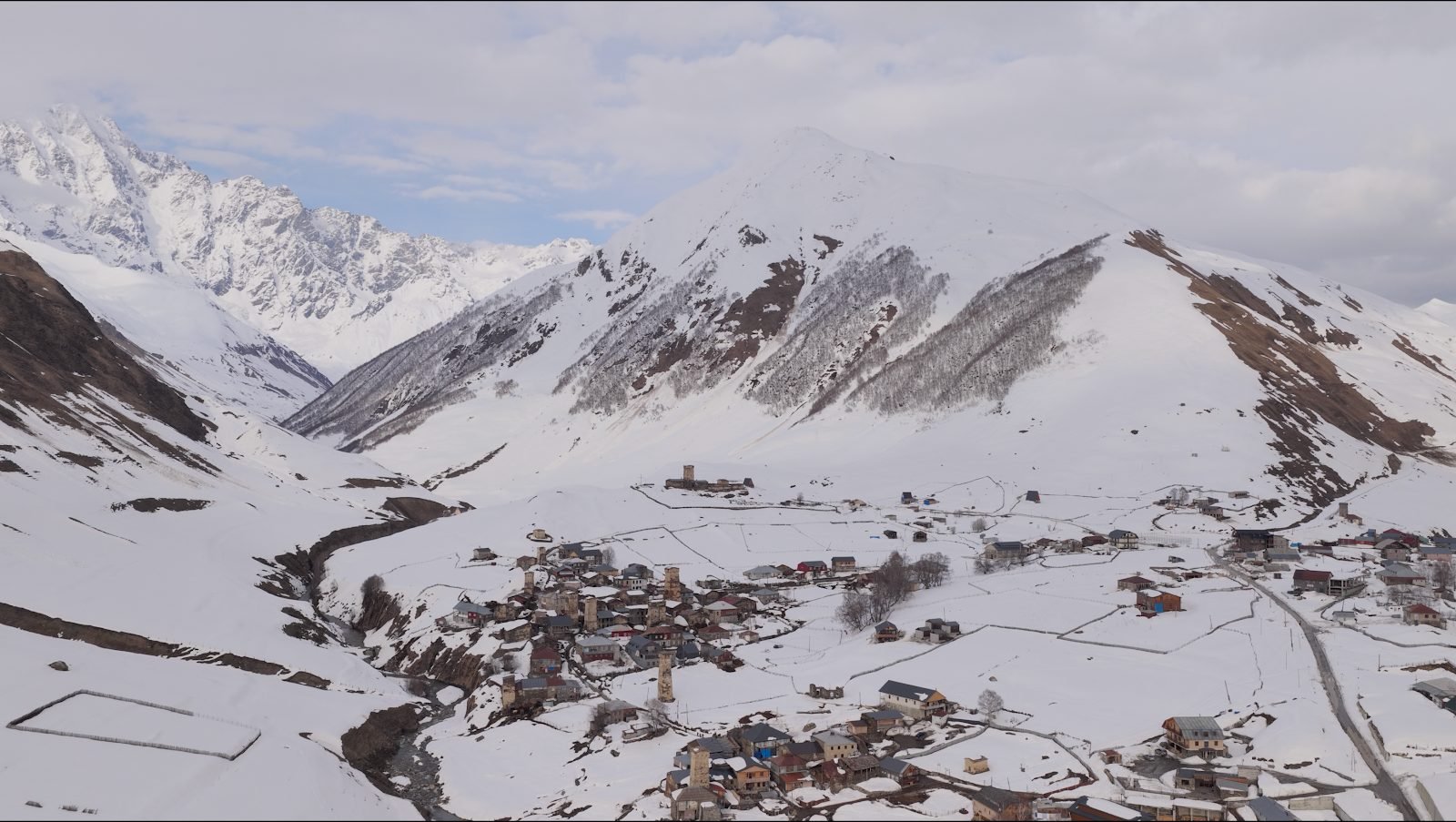
The final approach to Ushguli is a satisfying end because the route arrives in a living cluster of settlements rather than at a trailhead car park. Plan enough time to stay, walk through the villages respectfully and separate the end of the hike from the start of the road journey out.
Camping, guesthouses and food
The official TCT page describes plentiful wild-camping opportunities and notes that some guesthouses sell food to hikers. Treat that as route-wide context, not a guarantee for a particular night.
A flexible system works best:
- confirmed guesthouse nights where the stage clearly ends in a village;
- shelter and sleep system suitable for the conditions whenever camping is part of the itinerary;
- enough food to absorb a closed kitchen or changed stage;
- a water-treatment method even when streams and village sources are available;
- cash, because card service cannot be assumed outside Mestia.
Camp away from homes, fields, hay meadows, livestock routes and sacred sites. Ask locally when land use is unclear. Pack out rubbish, including food packaging and hygiene waste. “Wild” does not mean unowned or unused.
Navigation and current information
Carry the official route in at least two independent forms: an offline map/GPX on a phone and a backup available if that phone fails. A paper overview is useful for understanding exits even if it is not detailed enough for every junction.
Before leaving each valley, compare:
- the latest official TCT note;
- recent local information;
- the weather and visible conditions;
- what the group can actually do that day.
Old waymarks may coexist with newer signs or unrelated local trails. Construction, landslips and erosion can erase an obvious path. If the route on the ground and the digital track disagree, stop and diagnose the situation rather than forcing forward momentum.
Who should walk the full section?
Choose Chuberi to Ushguli if you can navigate independently, carry a changing food and shelter load, manage consecutive mountain days and accept that the itinerary may move. The TCTA rates the Chuberi–Nakra and Becho Valley–Mestia stages “Difficult”; read each stage’s difficulty, time and hazards in the official notes before deciding.
Choose Mestia to Ushguli if you want a shorter village-to-village trek, prefer a denser guesthouse network or have limited time. It is busier, but the scenery and cultural landscape are not lesser.
Consider guided support if your experience is mainly on fully signposted European hut routes, if you are travelling alone without remote-route experience, or if the western stages are the main reason for your trip. A guide should add current terrain knowledge and decision support, not merely walk in front of a GPS arrow.
How current is this page
This page is orientation, not the live route. The official Transcaucasian Trail overview, the five PDF trail notes, the GPX track and any current alerts own the line on the ground, and this text deliberately does not copy temporary trail alerts. Even the official notes can lag behind conditions on the ground — the TCTA says so itself. Svaneti Tours reviews this page before each hiking season against the official TCTA notes; the last review was completed in September 2026. If anything here differs from the official source, the official source is right: plan from it.
Related
Hiking
Guided programme
Mestia–Ushguli trek
Guided programme
Becho
Place guide
Mestia
Place guide
Ushguli
Place guide
Svaneti packing list
Guide
Plan this with us
Local Svan guides, based in Mestia all year round.